| Project Inception: | March, 2011 |
| Project Revised: | June, 2012 |
| Project Completion: | September, 2015 |
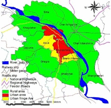
Mymensingh Strategic Development Plan (MSDP) Project, 2011-2031
MapsNew Maps
NewsNew
Gallery

Visitor Counter
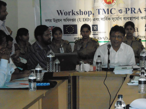
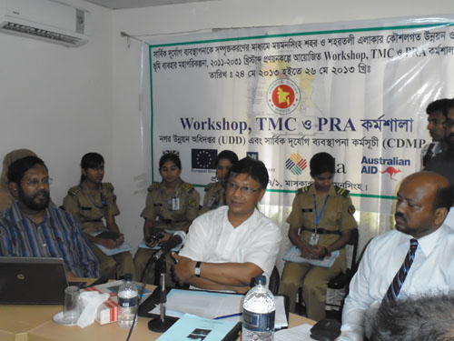
The "Disaster Risk Reduction and GIS Application" training is designed in the following three steps:
Firstly, 30 (thirty) officers and staffs would get the basic/introductory training on Disaster Risk Reduction and GIS & RS for two months (during May, 2012-July, 2012). The trainees have been separated into three groups. Ten computers have been procured to conduct the training sessions. These computers are also being used for data management and planning of Mymensingh (Municipality) Strategic Development Area.
Secondly, a mid-level training shall be arranged by CDMP for 15 (fifteen) officers and staffs of UDD and;
Lastly, advanced level training shall be arranged for GIS analysis for 09 trainee officers. CDMP will hire the consultant for rendering the training. Necessary logistic as well as other arrangements will be arranged by UDD and financed by CDMP. An office room will be arranged by UDD for the consultant.
Introductory /Basic Training on ArcGIS
(For all officers/ support personal working in UDD setup- 08 officers & 15 draftsman- surveyor)
For new GIS and/or ArcGIS users who wish to utilise the key functions of the software and not the complex data analysis functions. GIS concepts, data structures, loading data, symbolising, querying attributes, spatial & attribute editing and producing maps (layouts) are all covered. Content for basic GIS training is as follows:
- · Introduction to GIS
-
- · Introduction to ArcGIS
-
- · Basics of Arc Catalog
-
- · Using Arc Toolbox
-
- · ArcMap Interface
-
- · Managing Data Frames & Adding Data
-
- · Managing Map Documents
-
- · Symbolising Spatial Data
-
- · Controlling & Managing Data Display
-
- · Managing Attribute Tables
-
- · Attribute Queries
-
- · Basics of Spatial & Attribute Editing
-
- · Creating & Managing Labels
-
- · Creating Layout
-
- · Printing and Exporting Layout
List of Officers' and Staffs' Received Basic GIS Training
The Following Officers' and Staffs' Received In-House Basic GIS Training at UDD GIS Training Room.
|
Sl No |
Name |
|
Officers' |
|
|
01 |
Mr. Md. Shaheen Ahmed, Senior Planner |
|
02 |
Mr. Uday Sangkar Das, Senior Planner |
|
03 |
Mr. Md. Abdullah Al-Mamun, Planner |
|
04 |
Mr. Md. Ahsan Habib, Assistant Planner |
|
05 |
Mr. Shafiqul Islam Khan, Sociologist |
|
06 |
Mrs. Yearunnessa Kanam, Assistant Planner |
|
07 |
Mr. Mohammod Moklesur Rahman, Geographer |
|
08 |
Mr. Md. Borhan Uddin, Planning Assistant |
|
Staffs' |
|
|
09 |
Sree Harosit Barai, Draftsman-2 |
|
10 |
Mr. Md. Monir Hossain, Draftsman-3 |
|
11 |
Mr. SM Shydul Islam, Draftsman-3 |
|
12 |
Mr. Md. Abu Bakar Siddik, Draftsman-3 |
|
13 |
Md. Sohel Rana, Draftsman-4 |
|
14 |
Mrs. Maksuda Akhtar, Draftsman-3 |
|
15 |
Mr. Md. Abdul Alim, Survey Supervisor |
|
16 |
Mr. Momtaz Ali, Draftsman-4 |
|
17 |
Mr. Md. Abdul Hakim, Surveyor |
|
18 |
Mr. Md. Nazrul Islam, Draftsman-4 |
|
19 |
Mr. Md. Noor-e-Alam Siddique, Tracer |
|
20 |
Mr. Md. Anwar Hossain, Tracer |
|
21 |
Mr. Md. Raju Ahmed, Tracer |
|
22 |
Mr. A.K.M. Badrul Alam, Tracer |
|
23 |
Mr. Md. Mahmudul Hasan, Tracer |