| Project Inception: | March, 2011 |
| Project Revised: | June, 2012 |
| Project Completion: | September, 2015 |
Mymensingh Strategic Development Plan (MSDP) Project, 2011-2031
MapsNew Maps
NewsNew
Gallery

Visitor Counter
Strategic Development Plan of Mymensingh Town and Its Surrounding Region through Mainstreaming Disaster Risk Reduction in Land Use Planning, 2011-2031
Implemented by:
Urban Development Directorate (UDD),
Ministry of Housing and works,
Government of Bangladesh
Supported by:
Comprehensive Disaster Risk Reduction Programme II
1.Introduction
Bangladesh is predominantly an agricultural country, characterized by very low land-man ratio. At present national population growth rate of the country is about 1.43 percent (BBS, 2003) and the rate of urbanization is 7 percent per annum (BBS, 1997). The level of urbanization is 25 percent (WDB, 2007) with more than 28 million people living in the existing urban area. The trend for the last few decades reveals that the growth of urban population has doubled in every 12 years. The high level of urbanization is mostly liable to diminish the agricultural land to urbanization purpose. About 1% of agricultural land in each year is transferred to another use. The cultivable land in 1983-84 was 20-24 million acres and in 1997 was 17.45 million acre (MOL, 2001). If the rate continues in the future, it would be very alarming for the country. It is widely acknowledged that Bangladesh is a rapidly urbanizing country where urban base has expanded rapidly from 7.6% to nearly 25% between 1970 and 2005. A combination of socio-economic, political and demographic factors is responsible for this. It reflects for instance the redistribution of the rural and urban population. With an area of 147,750 square km, the agrarian economy of Bangladesh is experiencing a very high rate of urbanization. UN data estimates that currently 25% people of Bangladesh live in urban areas. This is indicative of the fact that growth of urban population and labor force is increasing relative to rural population and labor force. Planning is essential to arrest the haphazard and unplanned urbanization, and land use control. In the backdrop of rapid urbanization associated with increases in population and economic development in the early sixties, it was keenly felt that a regional and central office had to be created for Physical Planning. Accordingly Urban Development Directorate (UDD) was created on the 17th of July 1965, under the administrative control of Works, Power and Irrigation Department of the then East Pakistan, vide memo no. 464E, dated, Dhaka, July 17, 1965. Functions allocated to the directorate were enhanced in the year 1983, by the Martial Law Committee on Organizational set up, headed by Brigadier Enamul Haque Khan which was approved by the Review Committee, headed by Major General Atiqur Rahman. According to the Martial Law Committee on Organizational set up the functions as listed below are:
1.1 Functions of Urban Development Directorate
a. To advise the Government on matters of policies relating to
urbanization, land use and land development.
b. To prepare and co-ordinate regional plans, master plans and detailed
layout and site plans for the existing as well as the new urban centres
excluding the areas covered by the present town development authorities of
Dhaka, Chittagong, Khulna and Rajshahi.
c. To undertake socio-economic research and collection of data for
determination of the location and pattern of future urban development.
d. To prepare programmes for urban development for execution by the
sectoral agencies and secure approval of those from the National Council and
assist the agencies in selection of sites for implementation of those
programmes.
e. To act as a counterpart organisation and focal point in the Government for all internationally aided physical planning and human settlement programmes in the country.
f. To organise seminars/workshops for creating better physical planning awareness and to disseminate information through regular publication of the research and planning materials on urbanization and human settlement planning and development.
g. To conduct in-service training of the officers and staff of organizations involved in spatial planning and development.
h. To advise the existing urban development authorities on their operations at their request.
i. To secure approval of programmes and plans and obtain necessary fundsfrom the Government or any other agency approved by the Government.
2 Previous Achievements of UDD and UN-UDD Co-operation
Urban Development Directorate (UDD) has been working in close co-operation with UN agencies and other development partners like World Bank, IDA and ADB. Some of the notable projects as mentioned below:
(i) National Physical Planning Project (1st phase), in co-operation with UNDP, 1978-1982.
(ii) Urban Housing Policy and Programme Development (1st phase) with UNDP assistance, 1978-1981.
(iii) National Physical Planning Project (2nd phase), with UNDP, UNCHS assistance, 1983-1987.
(iv) Urban Housing Policy and Programme Development (2nd phase) with UNDP,UNCHS assistance, 1984-1986.
(v) Technical Assistance for the Design of Urban Area Development and Environmental Improvement, with World Bank, IDA assistance.
(vi) Housing Sector Institutional Strengthening Project, with ADB assistance, 1992-1993.
(vii) Urban and Shelter Sector Review, with UNDP, UNICEF and UNCHS assistance, 1992-1993.
(viii) A project titled "Pakistan: Location and Planning of Cities in East Pakistan" that was undertaken by the United Nations in the year 1960 and was executed in mid 1960s.
(ix) Preparation of Bangladesh National Report on Human Settlements (UN Habitat, 1996)
(x) Preparation of Bangladesh Country Report on Urban Indicators (2001)
(xi) Studies carried out jointly by UNDP, UNCHS and UDD under the project "Bangladesh Physical Planning Project". Some of the study reports are mentioned below:
Final Report of Prof. Milton Kaplon, International Consultant in Planning Legislation, National Physical Planning Project (BGD/81/005-BGD/72/104), January 1983.
(a) The Draft Physical Planning (Land Use) and Development Control Ordinance in its Land Policy Context, David L. Willcox (26/2/82-28/3/85).
(b) The Physical Planning (Land use) and Development Control Ordinance 1985, updated by David L.Willcox and Nuruzzaman Choudhury, March 1985.
(c) Final Report of Mr. Nuruzzaman Choudhury, National Consultant in Planning Legislation, 7-21, September 1985.
3. Activities of UDD in the Recent Past:
UDD has also completed the following activities by the own manpower of UDD in the recent past:
1. Preparation of Master Plan for the Establishment of Tungipara, Gopalganj District
as an International Standard Tourism Centre.
2. Preparation of Structure Plan, Master Plan and Detailed Area Plan of 09 (nine)Pourashavas/upazilas namely Homna of Comilla, Hajiganj of Chandpur, Sitakundu of Chittaganj, Dagonbhuiyan of Feni, Galachipa of Patuakhali, Pekua upazila of Cox's Bazar, Shahjahanpur of Bagura, Dhamrai of Dhaka, Mujibnagar of Meherpur, Zia Nagar of Pirozpur and Munsiganj of Munsiganj District.
3. Preparation of Master Plans/Land Use Plans for 6 newly declared Paurashava such as Tongipara, Katalipara, Godagari, Kalaroa, Rohanpur and Haragach.
4.Recent Achievements of UDD:
1 At present, UDD has implemented a project entitled, "Preparation of Development Plan of Cox's Bazar town and Sea-beach up to Teknaf". The estimated cost of the project is Tk. 384.671 Lach, which was solely borne from Revenue Budget of the Govt. As per approved PP, the duration of the project is from January 2009 to December 2009. But due to unavoidable circumstances, the project had been extended to another one year without changing the project cost. The objectives of the project are: to prepare Structure Plan, Urban Area Plan and Action Area Plan to develop Cox's Bazar town, Sea-Beach from Cox's Bazar to Teknaf, Moheshkhali Upazila town and St. Martin Island as tourist development area; to ensure maximum landuse of these areas as well as preparation of landuse control guidelines; develop beach cultural tourism; recreational tourism, city based tourism; to identify adequate area for eco-tourism development; to identify cultural pattern and coastal characteristics to develop guidelines & strategies for sustainable tourism development; to suggest institutional arrangements and activities for environment based management planning and finally suggest standard design of different govt., semi-govt. and autonomous institutions engaged in city development, economic development, employment, housing open space, education, health and recreation. The Project would guide planned landuse for around 25,000 acres of land in the project area with a time frame of 20 years (From 2010 A.D. to 2030 A.D. Though the project has no direct scope of employment generation, there will be huge employment generation through physical planning oriented planned development activities. The project at present under process of approval and gazette notification by the Ministry of Housing and Public Works.
2. UDD has also implemented a planning project entitled "Preparation of Structure Plan, Master Plan and Detailed Area Plan for Sylhet and Barisal Divisional Towns. The estimated cost of the project was BDT 551.89 Lakh which was solely borne by the govt. of Bangladesh from Revenue budget. The project started since 2005 and finished on June 2010. The objectives of the project were to prepare Structure Plan, Master Plan and Detailed Area Plan to control overall development of Sylhet and Barisal Divisional towns for the next 20 years; to prepare guidelines to ensure maximum use of land and to control landuse in the divisional towns. The project has ensured planned land use of 21,039 acres of land in Sylhet and 1867.16 acres of land in Barisal divisional towns. Project outputs of recently completed Sylhet and Barisal project are shown in Map-2 and Map-3.Moreover, UDD has recently completed one research/study entitled "Landslide in Chittagong: Causes, Effects and Counteractions". The project at present already been approved and gazetted by the Ministry of Housing and Public Works.
|
Figure 01: Historical and Attractive Areas of Sylhet Divisional Town |
Figure 02: Proposed Planning Map of Urban Area of Barisal Divisional Town |
Figure 03: Map of Project Area of the Project Entitled "Preparation of Development Plan of Cox's Bazar town and Sea-beach up to Teknaf" |
|
|
|
|
5 Policy and Act:
The draft "National Housing Policy 2010" and "Urban and Regional Planning and Landuse Management Act 2012" are in the active consideration of the present government.
6 Recent Achievements of the Ministry of Food and Disaster Management: Comprehensive Disaster Management Programme (CDMP)
Bangladesh is one of the most climate vulnerable countries in the world and will become even more so as a result of climate change. Floods, tropical cyclones, earth quack, storm surges and droughts are likely to become more frequent and severe in the coming years. These changes will threaten the significant achievements of Bangladesh which has made over the last 20 years in increasing incomes and reducing poverty, and will make it more difficult to achieve the MDGs. While acknowledging the level and magnitude of risks and vulnerabilities, Bangladesh has also received equal global recognition for its risk reduction, preparedness and emergency management skills and efforts which had helped the country to maintain declining trends in terms of human causalities and economic loss. During the last two decades the country has invested a significant amount of its own resource and resources of its development partners in creating the foundation for achieving the Government of Bangladesh Disaster Management Vision of "reducing the risk of people, especially the poor and the disadvantaged, from the effects of natural, environmental and human induced hazards, to a manageable and acceptable humanitarian level, and to have in place an efficient emergency response system capable of handling large scale disasters".
Realizing the necessity for a paradigm shift in disaster management from its conventional response and relief management approach to a more comprehensive risk reduction culture, the Government of Bangladesh along with its development partners designed and implemented the Comprehensive Disaster Management Programme (CDMP) Phase-I during 2003-2009. The goal of CDMP-I was to strengthen the capacity of the Bangladesh disaster management system to reduce unacceptable risks and improve response and recovery activities. CDMP-I followed a all hazard, all risk and all sector approach and the elements of CDMP-I were implemented through strategic, technical and implementation partnership arrangements with different 100 entities or organisations. After successful completion of CDMP-I, the phase-II has been launched.
CDMP-II (2010-2014) is a vertical and horizontal expansion of its Phase-I activities designed based on the achievements, lessons learned and the strong foundation laid during CDMP-I by continuing the processes initiated, deriving actions from the lessons learned, utilizing knowledge resources generated and knowledge products published. The approach of CDMP-II is to channel support through government and development partners, civil society and NGOs into a people-oriented disaster management and risk reduction partnership. That partnership will promote cooperation, provide coordination, rank priority programmes and projects, and allocate resources to disaster management activities, risk reduction activities and climate change adaptation activities in Bangladesh.
Considering above mentioned conceptual frame-work of CDMP-II, a pilot project on preparing a module for mainstreaming disaster risk preventive measures into comprehensive Land Use development planning and management for Mymensingh (Municipality) Strategic Development Planning (MSDP) Area for twenty years (2011-2031) time-span has been formed between CDMP-II and Urban Development Directorate (UDD).
A Memorandum of Understanding (MoU) was signed on 21 March, 2011 between the authorities of Comprehensive Disaster Management Programme (CDMP-II) of the Disaster Management & Relief Division (DMRD), Ministry of Food and Disaster Management (MoFDM) and Urban Development Directorate (UDD), Ministry of Housing and Public Works (MoHPW) at the presence of concerned Ministers. The area of collaboration is to prepare an integrated development plan covering Structure Plan, Urban/Rural Area Plan and Action Area Plans, and subsequent training module for Mymensingh (Municipality) Strategic Development Planning (MSDP) Area by including disaster (both natural and man-made) risk reduction measures into comprehensive land use planning and management.
7 Project Goal, Objectives and Outcomes of Mymensingh Strategic Development Project
7 Goal of Mymensingh Strategic Development Project
The overall goal of CDMP-II is to further reduce country's vulnerability to adverse natural and anthropogenic events – including cyclones, hurricanes, floods, tidal surges, earthquakes, tsunamis, climate change and variability, avian flu, fire, toxic chemical/gas/pollutant leaks – through technical assistance in risk reduction and comprehensive disaster management activities. The approach is to channel support through government and development partners, civil society and NGOs into a people-oriented disaster management and risk reduction partnership. That partnership will promote cooperation, provide coordination, rank priority programmes and projects, and allocate resources to disaster management activities, risk reduction activities and climate change adaptation activities in Bangladesh.
CDMP II offers an outstanding opportunity to improve linkages with, and synergies between, disaster risk reduction and adaptation to climate change. This applies both at the national and at the general stakeholder level. The linkages are clearly expressed in many of the activities outlined in the operational outcomes of the project design, as well as through strengthened institutional capacities. Under this opportunity, a Memorandum of Understanding (MoU) delineated the area of collaboration between CDMP-II and Urban Development Directorate (UDD). The area of collaboration is to prepare an integrated development plan covering structure plan, urban/rural area plan and action area plans, and subsequent training module through the integration of disaster risk information with the Physical/Structural/Land use plan of the township area.
8 Objectives Mymensingh Strategic Development Plan Project:
The objective of this MoU is to enhance the technical capacity of the relevant professionals for acquiring knowledge on the appropriate disaster risk reduction measures technique particularly earthquake to incorporate them into comprehensive land use development planning and management. The specific objectives of this MoU are:
I) A Pilot Project on Preparing a Module for Mainstreaming Disaster Risk Reduction Measures into Comprehensive Land Use Development Planning and Management for Mymensingh (Municipality) Strategic Development Planning Area.
II) Equipments support to develop a permanent "Geographic Information System (GIS) Laboratory", under "Urban Research and Development Application Centre (URDAC)" in UDD office.
III) Advocacy support to institutionalize the Urban Research and Development Application Centre (URDAC) through appropriate institutional approach (reforming organizational structure of UDD).
9 Outcomes of the Mymensingh Strategic Development Plan Project:
The project planning area will cover Mymensingh (Municipality) Strategic Development Area which might have potential for development within the next 20 years up to year, 2031 A.D. The project is planned to be completed in three stages/tiers. In the first stage, there will be preparation of Structure Plan for Mymensingh municipality and surrounding grater hinterland area. The second stage will be preparation of Urban Area Plan incorporating necessary data of urban (municipality) area and also preparation of Rural Area Plan for said hinterland area for assessing problems or opportunities, which need immediate intervention. The third stage will be preparation of Action Area Plan/Detailed Area Plan using relevant data from detailed CDMP physical feature survey in the form of sectoral projects and programs for immediate intervention based on local need. The current project would also emphasize over the change in land category, land use and livelihood pattern.
CDMP II is designed around the following six interrelated outcomes which will be related with proposed planning package (3-stages) described below:
Table: Outcome of CDMP and correlation with planning package
|
Relation with planning package |
|
|
Outcome 1: Development of strong, well-managed and professional institutions in Bangladesh that is able to implement a comprehensive range of risk reduction programmes and interventions at the national level, as well as contributing to regional actions, international learning and best practice. |
It will be identified at the structure planning stage through appropriate institutional intervention. |
|
Outcome 2: Reduced risk to rural populations through structural and non-structural interventions, empowerment of rural communities and improved awareness of, and planning for, natural hazard events, including the likely impacts of climate change. |
It will be incorporated within structure planning stage. |
|
Outcome 3: Reduced risk to urban populations through structural and non-structural interventions, improved awareness of natural hazard events and the piloting of urban community risk reduction methodologies targeting the extreme poor. |
It will be incorporated within Urban Area Plan under structure planning guideline through appropriate action plan. |
|
Outcome 4: Improved overall effectiveness and timeliness of disaster preparedness and response in Bangladesh by strengthening management capacity and coordination as well as networking facilities at all levels. |
It will be incorporated within Structure Plan and Urban Area Plan and Disaster Management Plan |
|
Outcome 5: Better disaster-proofing of development funding across thirteen ministries. This will achieved by generating increased awareness of hazard risks and the provision of technical information, advisory services and resources to stimulate positive changes in planning and investment decisions over the long-term. |
It will be incorporated at the each three stage of planning package. |
|
Outcome 6: Community-level adaptation to disaster risks from a changing climate is effectively managed. |
Action Area Plan/Urban Area Plan/Structure Plan and Disaster Management Plan |
Figure 4: Tiers of Development
Methodology for Preparation of Development Plan
10 Description of the Project Area
CDMP II is a natural expansion and a logical scaling up of its first phase, CDMP-I. The pioneering phase has laid the foundation for institutionalizing the risk reduction approaches and frameworks developed through pilot testing. It also aims to institutionalize the adoption of risk reduction approaches, not just only for the host Ministry of Food and Disaster Management, but more broadly also across thirteen key ministries and agencies of the Government of Bangladesh.
Urban risk reduction is a potential thematic area (Outcome 3) within six specific outcomes of CDMP-II, that comprises of reducing risk for urban populations through structural and non-structural interventions, improved awareness of natural hazard events and the piloting of urban community risk reduction methodologies that targets the extreme poor. This area covers the assessment and management of earthquake, landslide, hydrometorological and anthropological hazards in urban context.
As an action, CDMP II has taken initiative for earthquake preparedness and risk reduction activities which will be expanded as pilot project in six towns in Bangladesh, such as, Mymensingh, Tangail, Bogra, Rangpur, Dinajpur and Rajshahi under the thematic area of Urban Risk Reduction. Those towns have been selected based-on the earthquake macrozonation maps of Bangladesh National Building Code (BNBC), 1993.
According to the MoU, UDD has been given a pilot project on "Preparing a Module for Mainstreaming Disaster Risk Reduction Measures into Comprehensive Land Use Development Planning and Management for Mymensingh Strategic Development Planning (MSDP) Area" where the existing Mymensingh municipality is situated as a core urban area.
The Mymensingh Zila headquarter is located at a distance of about 121 km (75 miles) away from the capital of the country, Dhaka. The Pourashava (Municipality) is located within the Zila headquarters. It lies between the 24043' and 24045' north latitude and 90023' and 90025'east longitude.
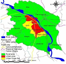
The project areas constitutes Mymensingh Paurashava and adjacent 10 (nine) unions of Mymensingh Sadar Upazila with an area of abour 27933.43 hectare or 69024.70 acre (Figure 7). Detailed administrative boundary of the project has been summarized in table below:
Table: Name and area of Mymensingh Strategic Development Planning (MSDP) area.
|
S/N |
Paurashava/ union name |
Area |
Population |
Density of Population per Acre |
||
|
acres |
hectares |
% |
||||
|
1 |
Akua |
3286.9 |
1330.16 |
4.76 |
41905 |
12.75 |
|
2 |
Baera (Kewatkhali) |
1430.56 |
578.93 |
2.07 |
22620 |
15.81 |
|
3 |
Bhabkhali |
7632.49 |
3088.77 |
11.06 |
43467 |
5.69 |
|
4 |
Char Ishwardia |
7150.91 |
2893.88 |
10.36 |
39095 |
5.47 |
|
5 |
Char Nilakshmia |
8022.88 |
3246.76 |
11.62 |
37917 |
4.73 |
|
6 |
Dapunia |
7014.1 |
2838.52 |
10.16 |
41690 |
5.94 |
|
7 |
Ghagra |
8379.64 |
3391.13 |
12.14 |
46842 |
5.59 |
|
8 |
Khagdahar |
6642.92 |
2688.31 |
9.62 |
36645 |
5.52 |
|
9 |
Paurashava |
5302.03 |
2145.67 |
7.68 |
227204 |
42.85 |
|
10 |
Sirta |
7337.31 |
2969.32 |
10.63 |
31485 |
4.29 |
|
11 |
Bhangnamari |
6825 |
2761.98 |
9.89 |
23215 |
3.40 |
|
12 |
Total area |
69024.7 |
27933.43 |
100.00 |
592085 |
8.58 |
Source: BBS, 2001 and GIS Lab, MSDP, UDD, September, 2011
Figure 05: Location of MSDP ( 2011-2031) Project Area with Respect to Bangladesh
Figure: Location of Structure Plan, Urban Area Plan and Rural Area Plan of MSDP (2011-2031) Project
11 On Going Activities of MSDP Project
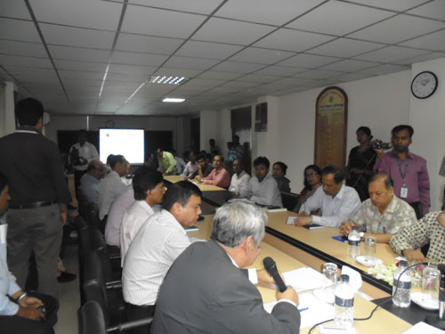
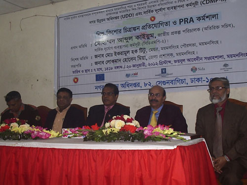
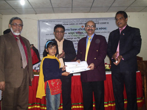
A pre-planning workshop was organized by UDD on 20 January 2012 with actively participation by the different stakeholders of the project. At the same day, an art competition was also organized for the children, who are the most vulnerable to different type of disasters and future generation of the project area and the nation as well, with the objective of creating awareness among the children against disaster and development of their own native town as well. Besides, a Participatory Rapid Appraisal (PRA) session was also conducted among the mothers of children participating in the art competition with the objective of creating awareness against disaster among them and also to gain practical firsthand knowledge about development prospects, problems and probable solution to the problems form the women's perspective as women are also among the most vulnerable to disaster in the society and widely neglected in the development process. Hence, a unique attempt is being made to mainstream the children and women into overall development process in such a way.
Recently ground truthing of physical features, which were obtained from satellite image interpretation, topographic surveys and both hydro-geological and engineering geological surveys have been conducted by Asian Disaster Preparedness Centre (ADPC), who were employed by CDMP for the said purpose. The survey activities of ADPC were duly monitored by UDD. After receiving the data from ADPC/CDMP, MSDP Project Team has checked the physical feature survey data at field level; and after necessary corrections MSDP Project Team would plot the surveyed data on mouza map for further checking of gathered data for preparing structure plan, urban area plan, rural area plan and detailed area plan by integrating multiple disaster risk into land use planning.
MSDP Project Team already has conducted pre-planning stage PRA sessions (in ten unions and twenty one in 21 wards of the paurashava) with the elected representatives of concerned unions of the surrounding the paurashava and also in all 21 wards of Mymensingh Paurashava to get a complete picture of the areas including their development problem, prospects of the area, probable solution to the problem, demand and vision for development. Moreover, a pre-PRA meeting was conducted with the Honorable Mayor, Mymensingh paurashava on policy related issues before conducting PRA in the paurashava. Moreover, PRA sessions with the Mymensingh Chamber of Commerce; and also with journalist and civil society of Mymensingh also has been conducted.
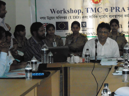
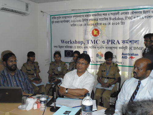
Another workshop was also held with different segments of the society at Mymensingh relating to development issues of Mymensingh on the 25th May 2013.
The first meeting of the Technical Management Committee (TMC) was held on the 26th May 2013 at Mymensingh. The TMC is satisfied with the progress of the progress work.
12 Conclusion
Disaster and development are considered as the inter-related process in the contemporary world, because, the natural environment is continuously threatened by the development activities. Human intervention creates ecological imbalance and as a result different types of man-made disasters strike human society at regular intervals and the social structure is being changed accordingly. There is no alternate to adaptation with disasters. Hence, in the process of paradigm shift between disaster mitigation and adaptation to create a disaster resilient the ongoing MSDP project under the theme "Mainstreaming Disaster Risk Reduction in Urban Planning Practices" would hopefully benefit the people of Mymensingh Municipality and its surrounding areas.